Hundreds of scenes captured by the MethaneSAT instrument before it lost communications on June 20 will continue to be processed and published on the MethaneSAT web portal and made available for download via Google Earth Engine – providing valuable insights to reduce methane emissions.
News of the satellite's loss led to a spike in requests for MethaneSAT data – indicating the public's high interest in analyzing and utilizing the existing data.
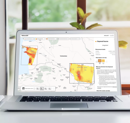
The first scenes collected by the satellite were published in November 2024 – providing a view of methane emissions that was previously not possible, including dispersed area methane emissions quantification at fine spatial resolution (4x4 km) and detection and quantification of discrete high-emitting point source emissions. Subsequent data revealed compelling insights and observations about methane emissions in crucial oil and gas producing regions worldwide
For example, repeated observations over Uzbekistan reveal how much emissions can change over time, highlighting the the value of regular monitoring and detection.