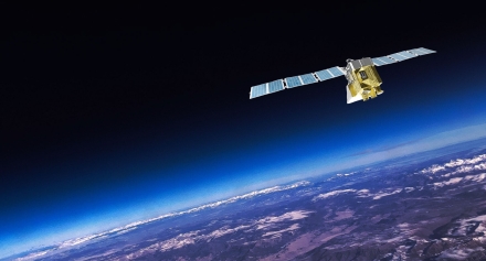
Since its launch in 2024, MethaneSAT promised to transform how the world detects and understands methane emissions. And until we lost contact with it in June 2025, the groundbreaking technology developed specially for our mission was doing exactly that. Companies, researchers and countries could, for the first time, identify and quantify large and small methane emissions over wide areas with historic precision and resolution – seeing methane that other satellites couldn’t.
Observations taken during the roughly 12 months that MethaneSAT was fully operational are generating new insights into methane pollution at scales and levels of precision that were previously out of reach. 2025 will be remembered as a remarkable year in the methane journey. As we look ahead, our focus is on ensuring that the knowledge MethaneSAT unlocked continues to drive action
The numbers
- By the end of 2025, the MethaneSAT team had acquired data over 41 oil and gas basins around the world, covering 25 countries and 50% of global onshore oil and gas production.
- In addition to oil and gas regions, we collected emissions data for agricultural and other sectors, bringing our total number of countries to 29.
- Nearly 800 researchers, analysts and technical users across industry, government, academia and NGOs were granted access to our Level 3 and Level 4 data on Google platforms (Earth Engine and Cloud Storage), and we continue to get a steady flow of requests for the data.
- EDF and Harvard researchers involved with the mission published 10 papers based on MethaneSAT data -- with many more in peer review -- and MethaneSAT researchers presented at 23 conferences and events.
- MethaneSAT has made nearly 2,000 files available to users and released more than 180 “scenes” (more on that in a minute).
Filling in a critical blind spot
One of the great features of MethaneSAT was its ability to identify and quantify total emissions from small sources across wide geographic areas -- not just the large, so-called “super emitters” that can be seen by other satellites. This valuable addition to existing research changed the scientific and policy conversations by definitively showing the huge role diffuse sources play around the world.
In February, a study led by EDF scientists and published in the journal Atmospheric Chemistry and Physics found that 70% of the roughly 15 million metric tons of methane coming from onshore oil and gas activities in the continental U.S. each year comes from smaller, dispersed sources of less than 100 kilograms of methane per hour. Nearly a third (30%) are from sites releasing less than 10 kilograms per hour. Previous EDF research had established the significance of smaller emission sources at specific locations.
Once you see a blind spot, you can’t stop thinking about it. And the MethaneSAT team hasn’t. That’s why we resumed aircraft monitoring of priority areas in the summer, which verified and expanded on MethaneSAT’s findings. Aerial data is available alongside the satellite data through the web portal and Google Earth Engine and Cloud.
New scenes around the world
In 2024, we began releasing what we call scenes – datasets and visualizations for specific regions over specific periods of time – that show precise emission levels, where they come from and how they change over time. We published more than 180 scenes in 2025, and we continue to examine the data to identify new high-value scenes that can inform corporate and regulatory decisions.
MethaneSAT data from 2024 and 2025 drew a stark contrast between emission levels in Texas and New Mexico, next-door neighbors in the Permian Basin, the world’s largest and most productive oil and gas basin. The data showed that the emissions intensity on the Texas side of the Permian was more than twice that on New Mexico’s side, even though the geography and many of the operators are the same.
The difference? New Mexico has implemented effective emissions reduction strategies since 2021, while Texas has lax and outdated standards.
Looking ahead
In a single year, MethaneSAT expanded global understanding, exposed critical blind spots, and raised expectations for transparency and action. And the mission continues: MethaneSAT will soon release novel insights based on MethaneSAT data comparing emissions intensities across more than 40 basins globally.
The data continue to inform science, policy, and accountability, and the insights will shape how the world measures, manages, and reduces methane emissions for years to come.