
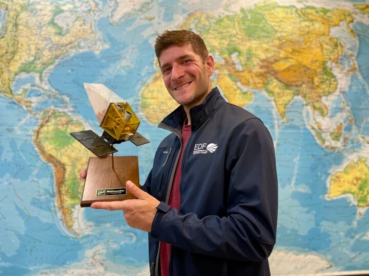
Our Team
We have experts from leading institutions worldwide working together to ensure the mission's success.


We are grateful to the supporters who made this project possible.
- Arnold Ventures
- The Audacious Project
- Ballmer Group
- D N Batten Foundation
- The Benificus Foundation
- Bezos Earth Fund
- Christina and Jeffrey Bird
- Builders Vision
- Catena Foundation
- The Ting Tsung and Wei Fong Chao Foundation
- The Children's Investment Fund Foundation
- J and Suzanne Crandall
- Rachel Crane
- John S. Curry
- Aart de Geus and Esther John
- Duff & Phelps Charitable Foundation
- Tony Fadell
- Global Methane Hub
- Bev Grant
- Heising-Simons Family Fund
- Barbara and Amos Hostetter
- King Philanthropies
- The Lemelson Foundation
- Patrick J. McGovern Foundation
- Julie and Ian McGuire
- The Cynthia & George Mitchell Foundation
- New Zealand Ministry of Business, Innovation, and Employment
- Charles M. Nunzio
- Bill and Susan Oberndorf Foundation
- Pat and Patti O'Donnell
- Signe Ostby and Scott Cook
- The Parke Family
- Quadrivium Foundation
- Robertson Foundation
- Ted and Linda Schlein
- Skoll Foundation
- Skyline Foundation
- Three Cairns Group
- Three Graces Foundation
- Valhalla Foundation
- Andrew W. Verhalen
- Sue Wagner and Neal Leonard
- Zegar Family Foundation
- Anonymous Donors
Meet the team
Lauren works with a diverse group of internal and external stakeholders to orchestrate and lead a complex, multi-pronged campaign to champion the capabilities of MethaneSAT – a high performance, purpose-built satellite to map and measure oil and gas methane emissions worldwide. She works to ensure the data MethaneSAT produced while operational can be used within government, industry, academia, the financial community and civil society to monitor, measure, and reduce oil and gas methane pollution to meet our 75% emissions reduction goal. Lauren also leads the EDF Rapid Response Room, a team of science, outreach and communications staff to review data and associated analysis as they are produced.
Sasha is a senior backend software engineer for MethaneSAT. He has a background in computational mathematics, and has previously worked in computer graphics (Techsoft3D), data processing pipelines (Google Poly), and computer vision (Google Lens).
Millie leads innovative projects that produce actionable data to help solve environmental problems. She currently leads Mission Impact for EDF’s MethaneSAT. Its ability to find and measure methane emissions with unequaled accuracy will provide the data required to motivate and reduce methane emission globally.
Andrew works with a variety of stakeholders within the oil and gas industry and the financial sector to drive continuous improvement in methane emission management and disclosure. His engagements with industry and investors also address additional near-term challenges and opportunities pertaining to oil and gas industry during the energy transition – including joint venture governance, mergers and acquisitions, and hydrogen development.
Joshua is a Senior Science Engineer for EDF, where he is working on the emissions detection and quantification systems focusing on atmospheric inversion of MethaneSAT and MethaneAIR observations to produce quantitative area-resolved methane fluxes. He also developed science and target planning software for MethaneSAT. He holds a BSc and MSc from the University of Waterloo in Canada and a PhD from Harvard University.
Emma is a frontend software engineer for MethaneSAT. Previously, she worked as a fullstack engineer at Tembo and PowerSchool, developing public data-reporting tools for state & local education agencies. In addition to her engineering experience, she brings a background in field biology and environmental education.
Liz joined MethaneSAT in 2025 as a Software Engineer. She has a background in linguistics and most recently worked at Florida Blue, working across four UI applications for the enrollment team.
Dr. Beata Bukosa's work on MethaneSAT includes developing the emission estimation models for agricultural diffuse sources, part of the New Zealand agricultural research programme.
Carlos is a software engineer focused on the back end of MethaneSAT’s Data Platform. Previously, Carlos was at Google, where he combined his knowledge of photography and software engineering to ensure that Google Maps had the best user-contributed photos possible. Additionally, Carlos has held engineering and leadership roles at Skybox Imaging, Yahoo! and Qualcomm.

Ju is a Ph.D. candidate in Environmental Science & Engineering at the John A. Paulson School of Engineering and Applied Sciences at Harvard University. She developed scalable point source emission estimation approaches for the MethaneAIR and MethaneSAT. Her approaches utilize high-resolution atmospheric simulations and remote sensing observations of greenhouse gases.
Jon oversees communications and media relations for MethaneSAT LLC, and, in a separate capacity, is Senior Director of Communications at Environmental Defense Fund. He has worked in environmental and energy communications with a wide range of non-profit and private sector clients and partners for more than 20 years.
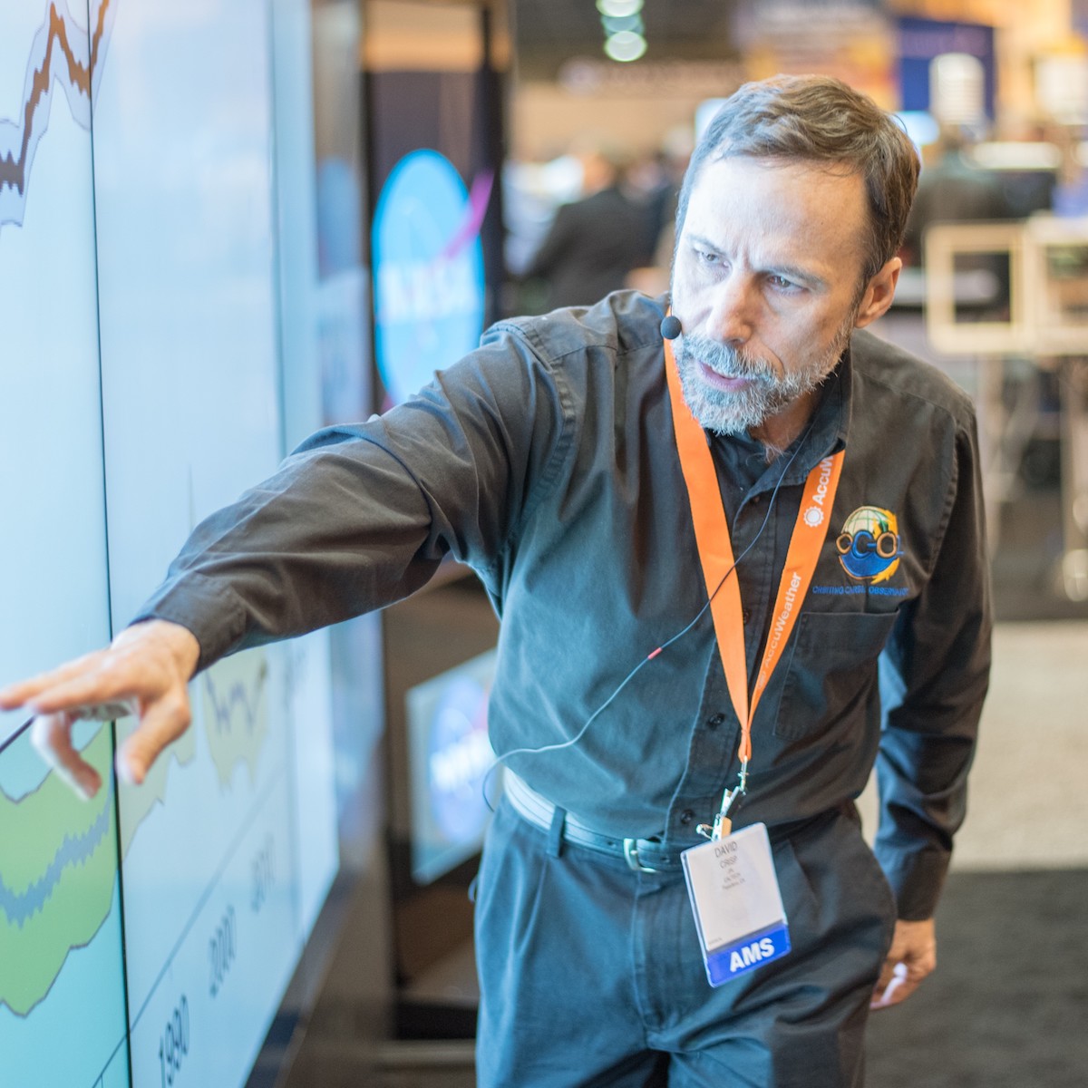
Dave is an atmospheric physicist and founder of Crisp Spectra, LLC an environmental science consultancy. Previously his career at NASA’s Jet Propulsion Laboratory focused on development of instruments and numerical models for analyzing light reflected, emitted, and scattered by atmospheres and surfaces of the Earth and other planets. He served as a flight instrument provider and science team member on several Earth, planetary and astrophysics missions. He was the Principal Investigator of the NASA Orbiting Carbon Observatory (OCO) mission and served as the science team leader for NASA’s OCO-2 and OCO-3 missions. He also served as the greenhouse gas lead for the Committee on Earth Observation Satellites (CEOS) Atmospheric Composition - Virtual Constellation (AC-VC) and member of the CEOS/CGMS Working Group on Climate Greenhouse Gas Task Team.
Bryn brings 40 years of experience in high-tech development to the MethaneSat team. In his most recent role, he served as System Architect at Lockheed Martin Space where he developed conceptual designs for new space systems and executed advanced design studies. Previous roles included Program Manager, Chief Engineer, and Director of Software Engineering as well as serving as the Director of Systems Engineering for Lockheed Martin Commercial Space Programs.
Yalun (Aaron) Feng is a Senior Manager, Energy Transition at the Environmental Defense Fund, where he leads global initiatives that leverage high-quality environmental data and satellite-based insights, such as MethaneSAT, to drive real-world emissions reductions in the oil and gas sector. His work sits at the intersection of industry engagement and capital markets, partnering with national oil companies, investors, and regulators to translate measurement-based performance into actionable finance and risk strategies. A core focus of his role is advancing investable methane finance through sustainability-linked instruments and results-based mechanisms that accelerate the path to net zero. Aaron holds a Master of Environmental Management from Yale University and a Bachelor’s degree from Vanderbilt University.
Jonathan is the Deputy Science Principal Investigator and Instrument Principal Investigator for MethaneSAT and is leading the calibration activities for the mission. He is a senior scientist at the School of Engineering and Applied Science at Harvard specializing in remote-sensing of methane and carbon dioxide. He also operates the Boston regional greenhouse gas column network which provides validation data to Earth observing satellites.
Lisa helps oversee the daily management and operations of MethaneSAT. She has fifteen years of experience managing a wide variety of projects in the science and technology space. Before joining MethaneSAT, Lisa worked with the National Science Foundation and National Science Board, and most recently, Environmental Defense Fund.
Will Furstenau plays a key role in designing and optimizing scalable and resilient cloud infrastructure to help ensure the success of the company’s mission. He joins us from Goldman Sachs, at which he helped manage systems that provided automated retirement advice for thousands of clients daily.
Ritesh oversees the MethaneSAT science team at EDF. He leads satellite remote sensing efforts focusing on the global oil and gas sector using MethaneAIR and MethaneSAT observations. Previously, Ritesh was a research scientist at NASA’s Goddard Space Flight Center in the Climate and Radiation Laboratory with Universities Space Research Association and a tenured faculty member at the Indian Institute of Technology (IIT Bombay). His experience is in satellite remote sensing of methane emissions, aerosols, clouds, snow and the climate effects of air pollution. Ritesh also serves as Co-Lead for the Atmospheric Composition and Asian Monsoon (ACAM) program. He has more than 70 scientific articles published in peer-reviewed literature.
Dr. Alex Geddes is a remote sensing scientist whose career has spanned atmospheric aerosols, trace gases, and cloud and radiation processes. Dr. Geddes plays a lead role in the agricultural component of the MethaneSAT and MethaneAIR, while also playing a central role in the newly funded FarmAI project, which leverages AI and Earth observation for farm-scale agricultural greenhouse gas monitoring. Recently appointed Remote Sensing Sector Lead, he is working to develop and support remote sensing capability across Earth Science NZ, bridging scientific innovation with national-scale applications.
Jon leads EDF’s efforts working with partners in government, industry and civil society to reduce methane emissions from the oil and gas industry across North America. He has led successful campaigns to craft and strengthen methane policies at the state and federal levels in the U.S., Canada and Mexico. His advocacy efforts have included testimony before congressional and legislative committees on the need to reduce oil and gas methane waste and pollution as well as serving as EDF’s lead on the National Petroleum Council’s 2024 study on greenhouse gas emissions from the natural gas sector.
George is a senior backend software engineer on MethaneSAT's Data Platform team. He brings a background in building highly scalable, cloud-based distributed systems. Before joining MethaneSAT, George held roles spanning engineering management, technical leadership, and co-founding engineer.
Dan Grossman is the Vice President - Global Energy Transition and is based in Colorado. His work focuses on global methane emissions from the oil and gas sector. Dan joined the organization in May of 2006, after serving ten years in the Colorado General Assembly. He served six years in the Colorado House of Representatives, including two years as House Minority Leader, the youngest person in Colorado history to serve in that capacity. Dan also served four years in the Colorado Senate, where he was the Chairman of the Judiciary Committee and Vice Chairman of the Senate Agriculture, Natural Resources and Energy Committee. During his service in the legislature, Dan practiced law focusing on commercial litigation and labor and employment law. Dan received his bachelors degree in Political Science from the University of Kansas and his law degree from the University of Denver.
In addition to his role on MethaneSAT, Luis supports the development of UNEP-IMEO's Methane Alert and Response System. His current research focuses on detection and quantification of methane point source emissions for MethaneSAT/MethaneAIR and other satellite missions. Luis is also a faculty member at the Universität Politècnica de València in Spain, leading the Land and Atmosphere Remote Sensing research group. Previously, he was head of the Remote Sensing Section of the GFZ Potsdam in Germany and Principal Investigator of the satellite imaging spectroscopy mission in 2014.

Kelly manages MethaneSAT's online presence across web properties and social media channels, and leads digital advertising efforts for the mission. She serves in a similar capacity for Environmental Defense Fund, where she has supported EDF's groundbreaking methane emissions research and methane advocacy within the Marketing and Communications team for more than a decade.
Harvey is a Geospatial Data Analyst for EDF working primarily on MethaneSAT and MethaneAIR datasets. His work collaborates with UNEP-IMEO’s Methane Alert and Response System and Harvard scientists to analyze point source emissions of methane from oil and gas sites across the globe. He holds a Master’s degree in Environmental Science (Pollution & Environmental Processes) from the University of Manchester
Chris is a software engineer focused on MethaneSAT's data processing pipeline. He brings extensive experience developing cloud services. In addition, Chris has worked on geographic information systems (VertGIS) and has led security & privacy engineering efforts at multiple organizations.
Steve is the project lead of MethaneSAT and, in a separate capacity, Chief Scientist at Environmental Defense Fund, where he initiated and oversaw an unprecedented initiative involving over 150 scientists from more than 40 institutions measuring methane leakage across the U.S. natural gas supply chain. Steven serves as Chief Scientific Officer for the United Nations Environment Programme’s Global methane studies, a joint effort of UNEP, EDF, DG Energy (European Commission) and the Oil and Gas Climate Initiative companies. He was previously on the faculty of Brown University for 16 years. He has published more than 100 scientific papers and served as a lead author for the Intergovernmental Panel on Climate Change.
Nat is the first Site Reliability Engineer on the Mission Operations team, supporting the tools used by satellite operators for command and control. He has a background in software test management, and comes to MethaneSAT from healthcare, where he was developing telehealth software infrastructure for a large hospital network when a pandemic started.
Shauda plays a pivotal role in increasing operational efficiency across teams and ensuring clear communication and coordination within EDF, MethaneSAT, and our partners. She helps keep EDF teams in sync on product strategy and data production, along with developing ways to measure the success and impact of MethaneSAT. She serves as the primary point of contact for all inbound communications and helps provide valuable insights that drive improvement and effectiveness of MethaneSAT products and value proposition.
Susan is the Senior Product Manager for MethaneSAT. After transitioning from the semiconductor industry into the clean tech industry, Susan held engineering positions testing and developing laser analyzers for environmental applications. Most recently she worked as a product leader managing the design and development of a hand-held methane leak detection solution.
Marvin is an atmospheric physicist specializing in greenhouse gas emission measurements. He joined the MethaneSAT team in August 2024, where he contributes to advancing our methods for estimating emissions on regional scales. Marvin’s work centers on quantifying total emissions and producing detailed regional flux maps. He earned his PhD from Heidelberg University in Germany, where he broke new ground by deploying a ground-based spectral camera for carbon dioxide and methane emission monitoring.
Fred is an influential voice on climate change, energy, and sustainability, and a champion for using the power of markets to protect our environment. Under his leadership since 1984, EDF has become one of the world’s largest and most influential environmental organizations. More recently, he coined the notion of a “Fourth Wave” of environmental innovation, where new technology, advanced analytics and collaborative problem-solving combine to shape smart policy and reward corporate responsibility, allowing both people and the planet to prosper. Fred introduced the idea for MethaneSAT in an April 2018 TED Talk.
Xiong has extensive expertise in satellite retrievals of trace gases and aerosols, and satellite instrument development and calibration. He developed one of the most advanced ozone profile and tropospheric ozone retrieval algorithms for ultraviolet measurements. He is currently the Deputy Principal Investigator for TEMPO, and is the SAO lead on science and algorithms for the MethaneSAT project.
Nick LoFaso is leading our data pipeline efforts, working closely with our partners at Harvard University. In his previous role at Lutron Electronics, Nick led development of a cloud-based service to allow programmable control of various lighting components. Nick has also held engineering positions at Red-Spark (advertising tech) and Lockheed-Martin.
Bingkun has extensive expertise in radiative transfer modelling and remote sensing of sea surface temperature, surface radiative budget, and cryosphere. His work includes analyzing instrument calibration and testing data, and developing calibration methods for MethaneSAT.
Ben is a Geospatial Analyst for the MethaneSAT science team assisting in reviewing MethaneSAT scenes and running analyses on data from the oil and gas sector. Prior to starting his position at EDF he worked as a geospatial analyst for another non-profit focused on oil and gas impacts in Texas and received both his bachelor's and master's from the University of North Texas studying Geography and Geospatial Science.
Dr. Makenzie Lystrup is an aerospace executive, planetary astronomer, and science-policy leader whose career spans scientific research, public service, and major space programs. Most recently, she served as director of NASA’s Goddard Space Flight Center, becoming the first woman to lead the center in 2023. Before joining NASA, she was vice president and general manager of Ball Aerospace’s Civil Space business, where she oversaw programs in space science, operational weather, Earth observation, and advanced technology development, including work supporting the James Webb Space Telescope, the Imaging X-ray Polarimetry Explorer, Landsat 9, and the Nancy Grace Roman Space Telescope.
Earlier in her career, Lystrup served as a Congressional Science & Technology Policy Fellow in the U.S. House of Representative, completed an NSF Astronomy & Astrophysics Postdoctoral Research Fellowship, and worked as an AmeriCorps volunteer focused on STEM education. She earned a bachelor’s degree in physics from Portland State University and a Ph.D. in astrophysics from University College London. Her scientific work has focused on planetary atmospheres and magnetospheres, and she has been recognized as a Fellow of AAAS, AAS, and SPIE for contributions spanning science, policy, and aerospace leadership.
Katlyn’s work focuses on characterizing the magnitudes and sources of methane emissions in major oil and gas producing basins globally. She is also involved in analysis of MethaneAIR data. Katlyn has nearly a decade of experience measuring methane emissions across the oil and gas sector. She holds a PhD in Oil & Gas Engineering from Memorial University and a Master’s degree in Earth Science from St. Francis Xavier University.
Russell brings over 25 years of experience in managing and developing complex software systems for mission-critical applications. Most recently, he served as Director of R&D at Qwaltec, overseeing creation of a TCPED Mission Operations SaaS platform on Amazon Web Services. His background includes multiple special programs involving airborne and spacecraft sensing technologies. He also has extensive experience in research, architecture, development, training, and maintenance of mission systems.
Courtney is a full stack software engineer for MethaneSAT. In her previous role, she helped launch the Google Solar API in an effort to accelerate residential solar panel installations. While at Google, she also worked on Google Maps and Street View.
Ethan Manninen is a fifth year PhD student in Steve Wofsy's group. Currently, Ethan is trying to understand how the temporal variability in methane plumes affects their contribution to total emissions.
Kira, a veteran digital strategist, helps optimize the way MethaneSAT presents data for maximum impact. Her prior experience includes leading Environmental Defense Fund's digital team, managing search and navigation products at AOL and helping launch the Washington Post's original web site.
Tom is leading the development of MethaneSAT's Data Platform, transforming sensor bits into actionable analytics. Before joining MethaneSAT, Tom was Technical Lead/Manager of the Geo Imagery Analytics infrastructure team at Google, where he led the development of scalable, fault-tolerant services to process, store and serve core metrics like oil tank volumes and car counts. Tom has also held senior engineering roles in Open Source and Cloud Commerce (Google), Big Data (Skybox Imaging) and near-real-time content delivery (Yahoo!).
Dr. Sara Mikaloff-Fletcher’s research focuses on using greenhouse gas observations from ground-based stations, aircraft, ships and satellites to quantify greenhouse gas emissions. She’s interested in quantifying greenhouse gas emissions and carbon uptake by the land biosphere at urban, regional, and national scale to support climate mitigation and policy. She is the Chief Scientist of the Changing Atmosphere Programme at Earth Science NZ. In addition, she is the Science Leader for New Zealand's MethaneSAT Science Programme, a multi-institutional research programme focused on mapping agricultural emissions around the world from satellite data.
Chris is an atmospheric physicist specializing in applications involving radiative transfer in planetary atmospheres. He leads the development for Level-2 scientific algorithms for retrieving atmospheric methane concentrations. Previously, he worked on Earth-observing satellites as part of the TEMPO and OMI science teams and was a Co-investigator of the NASA MEaSUREs. Chris was a physicist at the Harvard-Smithsonian Center for Astrophysics and obtained his PhD from Harvard University in Earth and Planetary Science.
Maya is focused on mission planning for in-orbit calibrations and development of machine learning models for MethaneSAT, with expertise in spacecraft/instrument operations, engineering systems, technology strategy, and space law and policy. She is the project lead and co-founder of HUMANS, an ISS and Lunar symbolic avenue for space access worldwide. She also served as co-lead of the Space Law & Policy Project Group at the Space Generation Advisory Council. She previously worked on space projects including NASA’s Mars 2020 Perseverance rover mission, Cassini’s mission activity on Titan, and the OneWeb satellites network. She holds Bachelor’s, Master’s, and PhD degrees in Aerospace Engineering from MIT.
Mark is a Senior Scientist for Environmental Defense Fund, working on the MethaneSAT project. His current work focuses on global methane emission assessment using MethaneAIR and MethaneSAT observations. His research background is in oil and gas methane emissions measurement and characterization. He holds a PhD in Chemical Engineering from Clarkson University and previously worked as a postdoctoral research fellow at Carnegie Mellon University.
Raia is a Ph.D. candidate in Environmental Science and Engineering at the John A. Paulson School of Engineering and Applied Sciences at Harvard University. Raia’s work leverages the underlying distributions of data within methane plume masks to identify spurious and diffuse plumes in MethaneAIR and MethaneSAT observations. This probabilistic approach to plume classification aims to augment the Level 4 point source QA/QC process.
Léa (she/her) is an EU energy and climate policy expert driven by the need to solve climate change, by championing better EU policy decisions. She brings both advocacy and analyst expertise combined with years of research experience having earned a Ph.D. on EU-China sustainable energy relations. In her role as senior EU policy manager for EU energy transition, Léa is leading on advocacy to help move forward progressive EU methane and hydrogen policy, also considering the international dimension. Previously she worked at the Brussels-based think tank E3G on European Green Deal diplomacy. Léa speaks French, German and English.
Sébastien works on the scientific algorithms used to derive the MethaneSAT Level 2 products. During his PhD at the University of Toronto, Sébastien experimented with a new algorithm of the Total Carbon Column Observing Network to retrieve vertical profile information of carbon dioxide concentration. He also worked on processing solar spectra from the Eureka (Nunavut, Canada) TCCON site. In a different project, he made use of NASA's ReFRACtor algorithm.
Marcus is a software engineer working on MethaneSAT’s data processing pipeline. His background is in computer science and infectious disease modeling. He brings extensive experience productionizing scientific computing workflows and building near-real-time modeling platforms, and has worked on Bayesian statistical inference and other simulation models.
Jenna is an astrophysicist at the Smithsonian Astrophysical Observatory. She is overseeing the design, construction and testing spectrometers used in the MethaneAIR flight simulations for MethaneSAT, and on applications of MethaneAIR for studies of methane emissions in North America.
Maryann is a research scientist at the John A. Paulson School of Engineering and Applied Sciences at Harvard University. She developed a framework consisting of a sensor array a statistical transport model to quantify methane and carbon dioxise emissions in the Boston urban region. Her work on MethaneSAT includes designing models to quantify methane emissions from point and regional sources.
Ravi is a Senior Software Engineer at MethaneSAT, focusing on building tools to visualize and act on methane emissions data. With a background spanning ecology, medicine, and full-stack software development, he brings a mission-driven, interdisciplinary approach to climate tech, and is passionate about using technology for public good.
Ruby holds a Bachelor of Journalism from the University of Texas at Austin and a minor in Environmental and Sustainability. Since joining the Environmental Defense Fund’s Energy Transition team in 2021, she has played a key role in shaping and executing digital communications strategies across global methane, transportation, and MethaneSAT initiatives. She leads content development for MethaneSAT’s social media channels and newsletter and drives the creation of visual and digital assets that elevate the project’s visibility and impact across platforms.
Lauren’s work focuses on the management of the data lifecycle and ensuring data is well documented and available for public use. Previously she worked at Axiom Data Science and the National Academies of Science, Engineering and Medicine with a focus on making data available from the Deepwater Horizon oil spill in the Gulf of Mexico.

Following a career as an admin assistant in the legal and educational fields, Kat attended a Software Bootcamp to expand her skills and change careers. MethaneSAT is her first foray in the world of software engineering.
Justin Tyberg is building out the cloud infrastructure that will host both the MethaneSAT data processing pipeline and the data products. Justin has built and managed cloud infrastructure across multiple cloud providers for several companies. He also has experience in software development, data science, and aerospace engineering.
Peter leads the ground system development and mission operations for MethaneSAT. He has worked in industry, academia and at NASA, bringing over 30 years of senior leadership experience in space systems and flight operations for a range of space science missions. Most recently, he oversaw development of deep space navigation for the UAE’s Hope Mars mission and systems engineering for a university-led astrophysics cubesat project.
Tom is an algorithms software engineer working on the MethaneSAT data processing pipeline. With a background in theoretical physics, he brings expertise in both analytical and numerical techniques. Having worked as a software engineer, he also has experience producing reliable, documented, and tested software.
Julio recently graduated with a bachelor’s degree in Computer Science from Northwestern University and took on a software engineering internship with MethaneSAT following graduation. Now a Front-End Software Apprentice, he works on the UI for the data platform.
Eleanor is a Ph.D. candidate in Environmental Science & Engineering at the John A. Paulson School of Engineering and Applied Sciences at Harvard University, where she studies greenhouse gas emissions using remote sensing and works on improving the MethaneSAT product. Her work has included the discovery of the first power plant carbon dioxide emissions seen by MethaneSAT, quality control flags for the MethaneSAT operational pipeline, and the analysis of the MethaneSAT flux product in areas affected by carbon dioxide emissions.
Jack joined Environmental Defense Fund in 2021 researching methane emissions in the Permian Basin as part of the PermianMAP project. As part of the MethaneSAT science team, his research and analysis now focuses on the evaluation, attribution, and analysis of methane emission sources detected by MethaneAIR and MethaneSAT observations globally. He has a bachelor’s degree from Columbia University.
Kaiya is a Geospatial Analyst focusing on large-scale oil and gas and non-oil and gas data and other geo-analytics. He worked as a geospatial data scientist in the past, and obtained his master’s and bachelor’s degrees from Boston University studying Remote Sensing/Geospatial Sciences and Earth/Environmental Sciences.
Matthew Welch (he/him) coordinates calendars, global travel, and provides executive-level support. He has over a decade’s experience with environmental NGOs.
James Williams joined the MethaneSAT science team in June 2023. His work focuses on characterizing diffuse area methane emissions and developing emission distribution curves from the oil and gas sector. His previous research involved direct measurements and inventory development of methane emissions from abandoned oil and gas wells, gas distribution infrastructure, landfills, sewers, and urban water bodies. He earned his PhD at McGill University in Montreal, Canada.
Steven is an Abbott Lawrence Rotch Professor of Atmospheric and Environmental Science; Area Chair for Environmental Science and Engineering. His efforts span the range of processes affecting atmospheric chemistry, including pioneering work on determining regional emissions of methane and carbon dioxide using ground, aircraft, and remote sensing measurements. His studies aim to understand underlying causes for change in atmospheric composition in order to mitigate impacts and provide scientific information for societal decisions.
Hanling Yang is an Associate Vice President of Energy Transition at EDF. She is responsible for developing and overseeing the implementation of EDF’s strategies and campaigns in key countries in the Asia-Pacific region to facilitate an equitable transition away from fossil fuel dependence, with a focus on halting the rise of fossil fuel emissions on a path consistent with a 2050 zero-carbon future. In this role, she works closely with a wide range of stakeholders—including governments, industry leaders, and civil society—and leverages MethaneSAT data to inform effective policy design and implementation, helping to accelerate methane mitigation efforts across the Asia-Pacific region.
Before joining EDF, Hanling was an Associate Director of the U.S – Asia Partnerships for Environmental Law at Vermont Law School, working collaboratively with government institutions, research institutes and legal professionals to advance environmental governance. Hanling also worked at the International Sustainable Development Foundation in Portland Oregon managing a decade-long sustainable land use and urban planning training program and green community projects.