Global data gathered by MethaneSAT during its year in operation show that emissions from the global oil and gas industry consistently exceed the figures reported in commonly cited inventories by significant margins. Moreover, performance varies widely across oil and gas producing basins, yet even the basins with the lowest emission intensity are falling far short of the industry's own emissions goals, suggesting a pressing need to broaden industry and government efforts to reduce emissions.
The results showcase the unique insights made possible by MethaneSAT technology. The ability to see total emissions, including smaller, dispersed sources that other satellites can’t, reveals how much these often-overlooked sources are contributing to the problem, and underscores the need for comprehensive, ongoing global methane measurement to track progress against both regulatory and voluntary targets.
Key findings from the MethaneSAT data
- Overall oil and gas methane emissions as measured by MethaneSAT were 50 percent higher than reported in the widely cited Emissions Database for Global Atmospheric Research and U.S. EPA’s Greenhouse Gas Inventory.
- Methane intensity in basins where natural gas is the main product tends to be lower than basins where oil production is central (and gas often treated like a byproduct). But in basins where gas accounts for 20 percent or more of the energy produced, absolute emissions observed by MethaneSAT were three times higher than reported in global inventories based on emission factors and engineering estimates.
- Conversely, emissions measured by MethaneSAT in basins where oil is the main product (where natural gas is less than 20 percent of the energy produced) were, on average, 30 percent lower than inventories. The difference between measured emissions and factor-based estimates used in inventories highlights the global need for accurate data to track progress in reducing emissions and noting which companies and countries are making progress toward meeting their commitments.
- Low-producing wells contribute an outsized share of emissions: Using MethaneSAT’s unique high precision, high resolution measurements, we calculate that 40 percent of methane emissions in production-only portions of eight top oil and gas basins in the U.S. came from areas responsible for less than seven percent of production.
The much more complete emissions picture made possible by the fine detailed data provided by MethaneSAT underscores the importance of comprehensive regulatory and monitoring frameworks. Such measurements make it possible to undertake more targeted programs focused on oil and gas emissions reductions and industry-led initiatives that take a systematic and sustained approach to improving emissions performance, irrespective of company size or ownership structure.
Regular, reliable detailed emissions data on a global scale is essential for tracking progress whether through government regulation, such as Canada’s recently enacted oil and gas methane regulations, or voluntary industry efforts like the Oil and Gas Decarbonization Charter, under which 56 oil and gas companies have pledged to achieve near-zero methane emissions and zero flaring of methane by 2030.
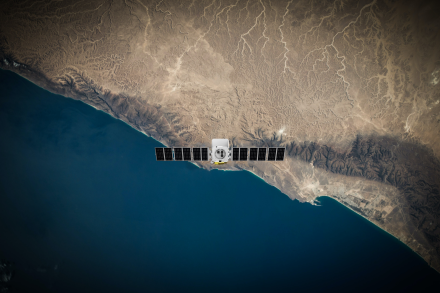
What the satellite saw
MethaneSAT has released data showing more than 221 scenes in 45 different oil and gas-producing regions globally, together accounting for half of the world’s onshore oil and gas production. Measurements were collected over roughly a year before an unanticipated loss of communications prematurely ended the mission last June.
This data allowed us to compare and rank basins around the world based on total emissions, as well as methane intensity. Measuring methane intensity — the amount of methane emitted relative to the amount of marketed gas — is especially important as global gas buyers begin to implement performance standards for natural gas imports. (Intensity can also be calculated by comparing measured emissions to total energy produced from both oil and gas.)
MethaneSAT measurements show that emissions intensity varies considerably from region to region depending on a variety of factors, such as the age and upkeep of oil and gas infrastructure, operating practices, regulation and pipeline takeaway capacity. Emissions at the basin-scale ranged from 10 metric tons per hour to over 400 metric tons per hour.
Importantly, although performance varied widely, none of the basins we measured reached the 0.2 percent emissions intensity goal agreed to under the OGDC. This is true regardless of whether intensity is calculated against market gas volumes or total energy value.
Global oil and gas methane intensities observed in the data ran the gamut from around 0.6 percent to more than 20 percent of marketed gas production (or roughly 0.04 kg/GJ to over 1 kg/GJ when normalized by total energy production).
Notably, only three basins where gas is the main product had methane intensities less than one percent (Hassi R’Mel in Algeria; and the Appalachian and Haynesville basins in the U.S.). Among all basins, even the regions with the lowest methane intensity — such as the Widyan Basin in Saudi Arabia and the Appalachian Basin in the United States — exhibited methane intensities exceeding 0.033 kg/GJ (equivalent to 0.2 percent of marketed gas).
Regions around the world where natural gas is the main product generally were observed to have lower methane intensity than basins where oil is primary and gas is often treated as a byproduct that is either burned off in thousands of flares or simply vented into the atmosphere.
For those basins with at least 20 percent of the energy produced coming from natural gas, emissions were three times higher than reported in inventories. For basins producing largely oil (where less than 20 percent of the energy produced comes from natural gas), emissions were 30 percent lower than those reported in inventories.
Discrepancies revealed by MethaneSAT indicate that emissions reported in inventories using current methods (which rely heavily if not exclusively on emission factors and/or engineering estimates) are presenting an inaccurate picture, spotlighting the critical need for accurate satellite-based measurements.
Rules matter
MethaneSAT data also shows the beneficial impact of better emissions rules. While long-anticipated federal regulations were put on hold by the Trump administration in the U.S., we can see that state standards have had a powerful benefit.
For example, our measurements show the methane intensity of producers in the New Mexico side of the Delaware sub-basin of the Permian — which has strong oil and gas methane regulations — is less than half what it is next door in Texas, which lacks strong state regulations.
Missing methane
Large differences between reported emissions and what was observed by MethaneSAT results from the ability to quantify total emissions, including not just large, concentrated sources, but also smaller, more diffuse emissions scattered across wider areas difficult for other satellites to quantify. These diffuse sources may include leaky pipelines and other infrastructure, but also — particularly in the U.S. — the growing number of old, low-producing wells.
A crucial measurement tool
MethaneSAT enables us to produce methane analytics in a standardized way across basins, making it possible to compare and contrast performance both across regions and over time — metrics essential for gas buyers and industry commitments like the OGDC.
In fact, there is no better way to compare and contrast emissions performance.