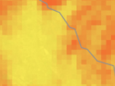
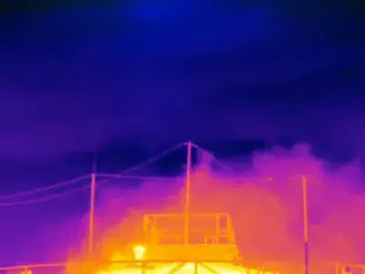
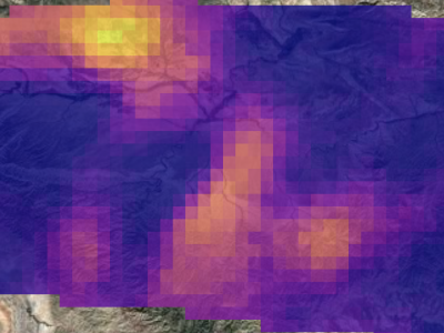
Case studies from MethaneAIR flights
The MethaneSAT team has been conducting flights, testing equipment, and gathering methane data with sensors installed on a jet aircraft.
A 2022 study revealed that smaller, low-producing wells are responsible for half of the industry's methane pollution from the production sector, and therefore it is critical to quantify total emissions resulting from smaller diffuse area sources as well as high-emitting point sources which together in aggregate helps build a more complete picture of the overall emissions.
Data users can access multiple types of measurements, and deploy solutions in the places where methane volumes are highest.
Explore MethaneAIR data on Google Earth EngineAtmospheric Measurement Techniques: Spectral calibration of the MethaneAIR instrument
Developing a spatially explicit global oil and gas infrastructure database for characterizing methane emission sources at high resolution
MethaneAIR: Airborne Imaging Spectrometer Level 2 Ungridded Data
Methane Point Source Quantification Using MethaneAIR: A New Airborne Imaging Spectrometer
Copyright © 2024 Environmental Defense Fund. All Rights Reserved. Privacy statement. Terms of Use.
Environmental Defense Fund is a nonprofit, tax-exempt charitable organization under Section 501(c)(3) of the Internal Revenue Code. Donations are tax-deductible as allowed by law. Tax identification number 11-6107128.
EDF operates with the highest standards of ethics and open, honest communication. Read our whistleblower policy or report a concern through our confidential, third-party compliance site.